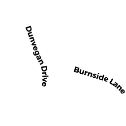
18 BURNSIDE LN
Owner Information
COUSINS SCOT E
18 BURNSIDE LN
MERRIMAC, MA 01860-2105


Property Details
18 BURNSIDE LN is classified as a Single Family Residential (Cape).
The primary structure on this property was built in 1994. There are 1,848ft2 of built area within this property. There is 1,848ft2 of residential/living space within this property. This property is listed as having 5 rooms.
18 BURNSIDE LN is valued at $452,700. The land is valued at $227,600 and the structures are valued at $225,100.
This property is in Zone SR. Confirm with local Zoning Board authorities to ensure there are no overlays or other easements on this property.
The most recent deed for 18 BURNSIDE LN is recorded at the local registrar in Book 27074, Page 271. 18 BURNSIDE LN was last sold on Thursday, August 2, 2007 for $305,000.
Assessment data from fiscal year 2022.
Flood Data
According to the FEMA National Flood Hazard Layer, this property does not appear to be in a flood zone. It may also be in an area not yet reviewed. Nonetheless, confirm this information prior to taking any action.
To view the flood hazards around this property, create a FEMA "Firmette" Map of the area around 18 BURNSIDE LN.
Broadband Internet Providers
| Provider | Type | Bandwidth (mbps) | |
|---|---|---|---|
| Comcast | Cable | 1000 | 35 |
| T-Mobile | Fixed Wireless | 25 | 3 |
| Verizon New England Inc. | DSL | 7 | 0 |
| Viasat Inc | Satellite | 100 | 3 |
| GCI Communication Corp. | Satellite | 0 | 0 |
| HughesNet | Satellite | 25 | 3 |
| VSAT Systems, LLC. | Satellite | 2 | 1 |
Broadband service provider data from December 2020.
Adjacent Properties
- 12 DUNVEGAN DR
Single Family Residential owned by THOMAS PAMELA J - 20 BURNSIDE LN
Single Family Residential owned by AMMON MARIA M - 14 DUNVEGAN DR
Single Family Residential owned by ZARELLA BRANT C - 16 BURNSIDE LN
Single Family Residential owned by MCHUGH DAVID R - 14 BURNSIDE LN
Single Family Residential owned by KOLIFRATH PETER D